The evolution of Phnom Penh
The capital’s growth has been centuries in the making. In this compilation sourced from libraries and other digitised collections, cartographers mapped the expansion of the city from a riverside settlement to a modern metropolis
By Andrew Haffner
Phnom Penh’s frenetic growth has changed the face of the city again and again. But while the city has been remade in the past decade, it’s never remained static for long.
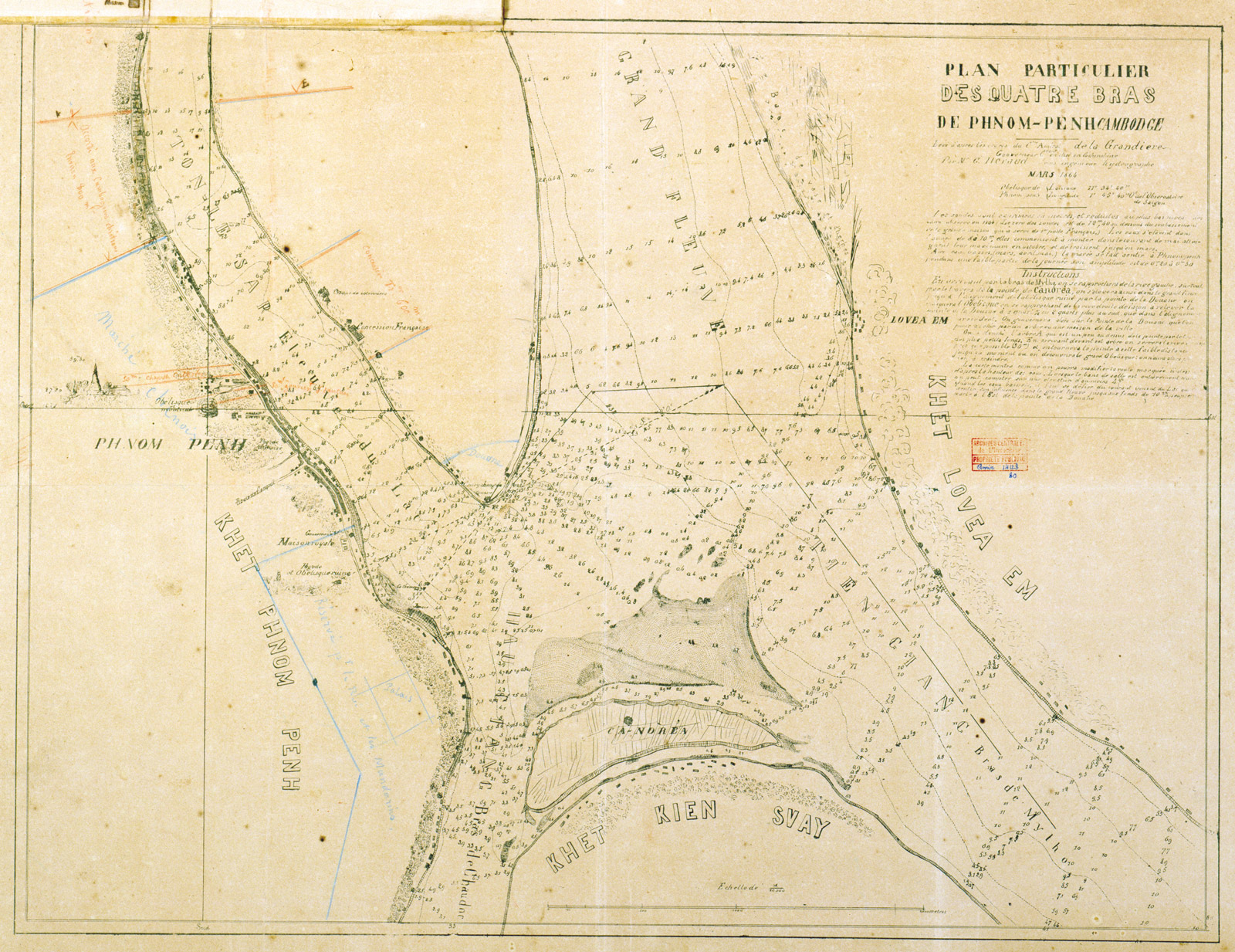
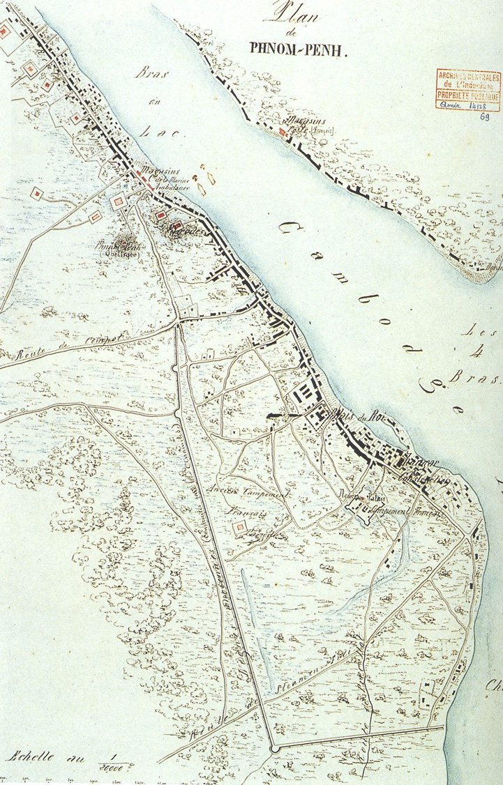
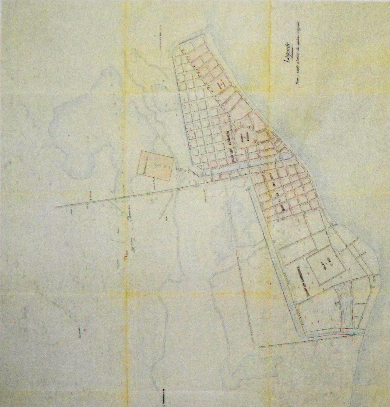
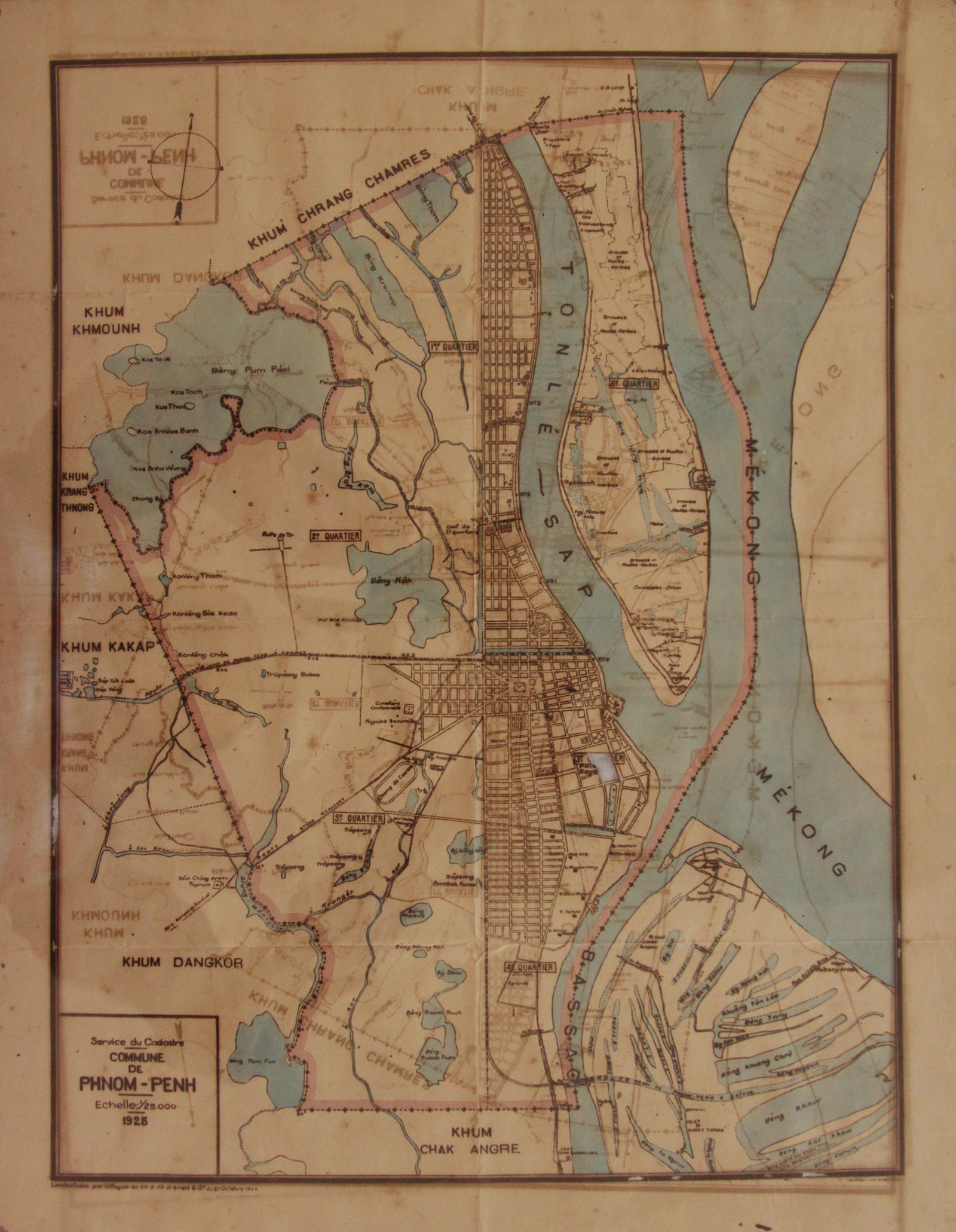
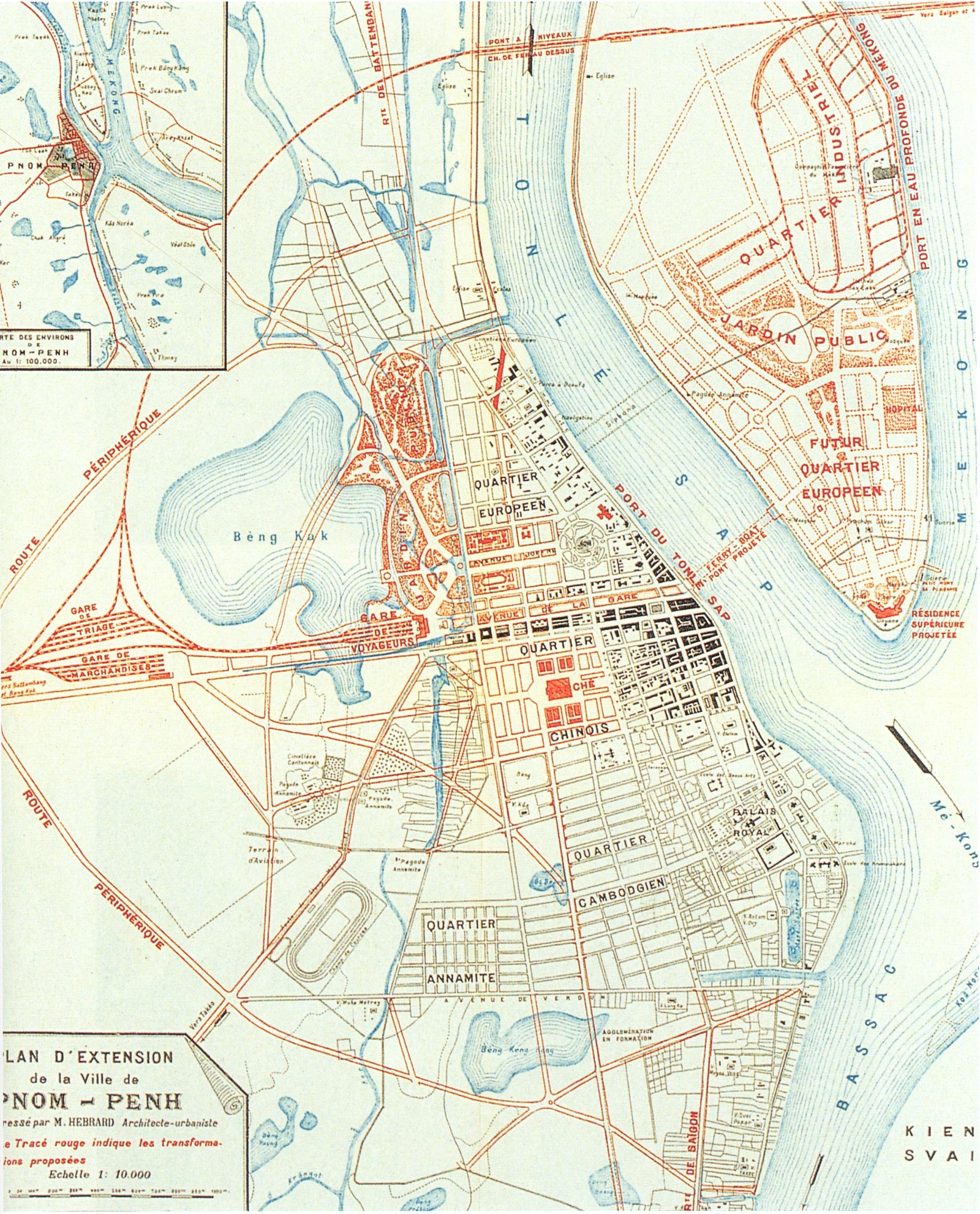
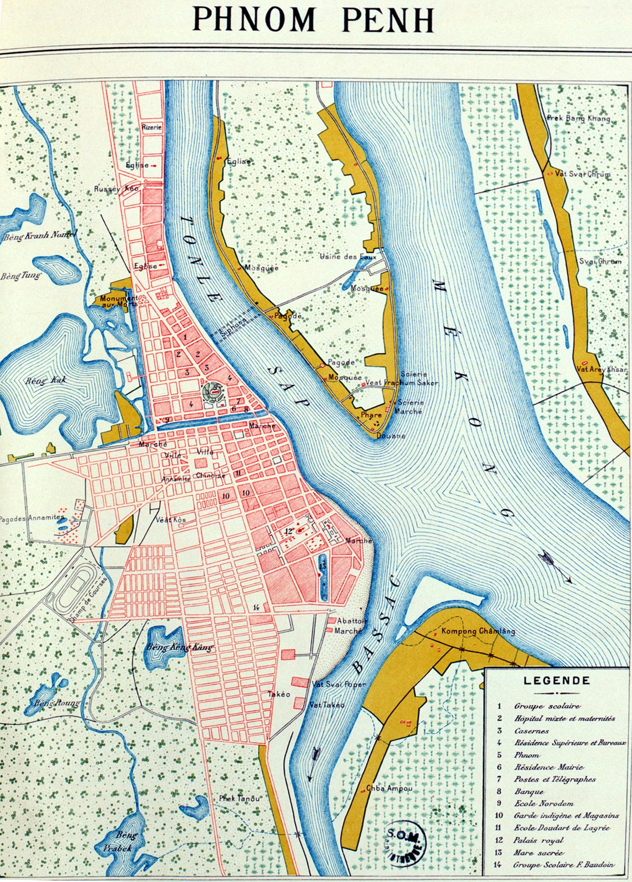
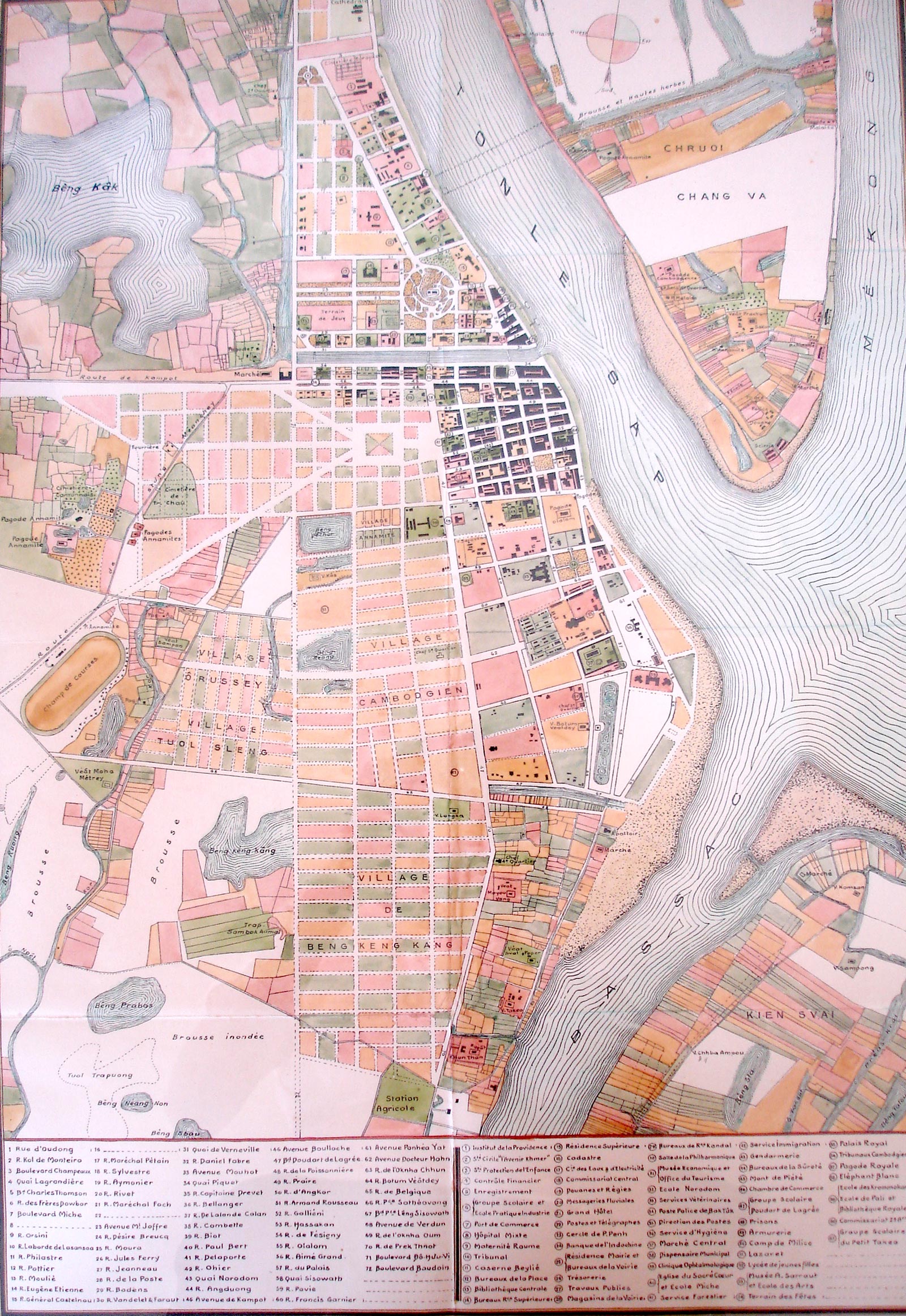
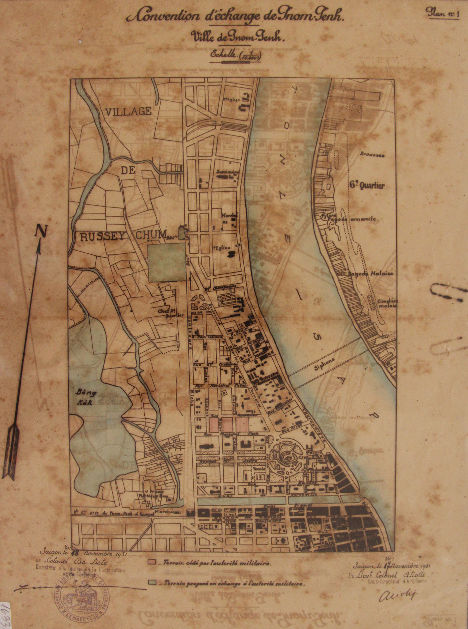
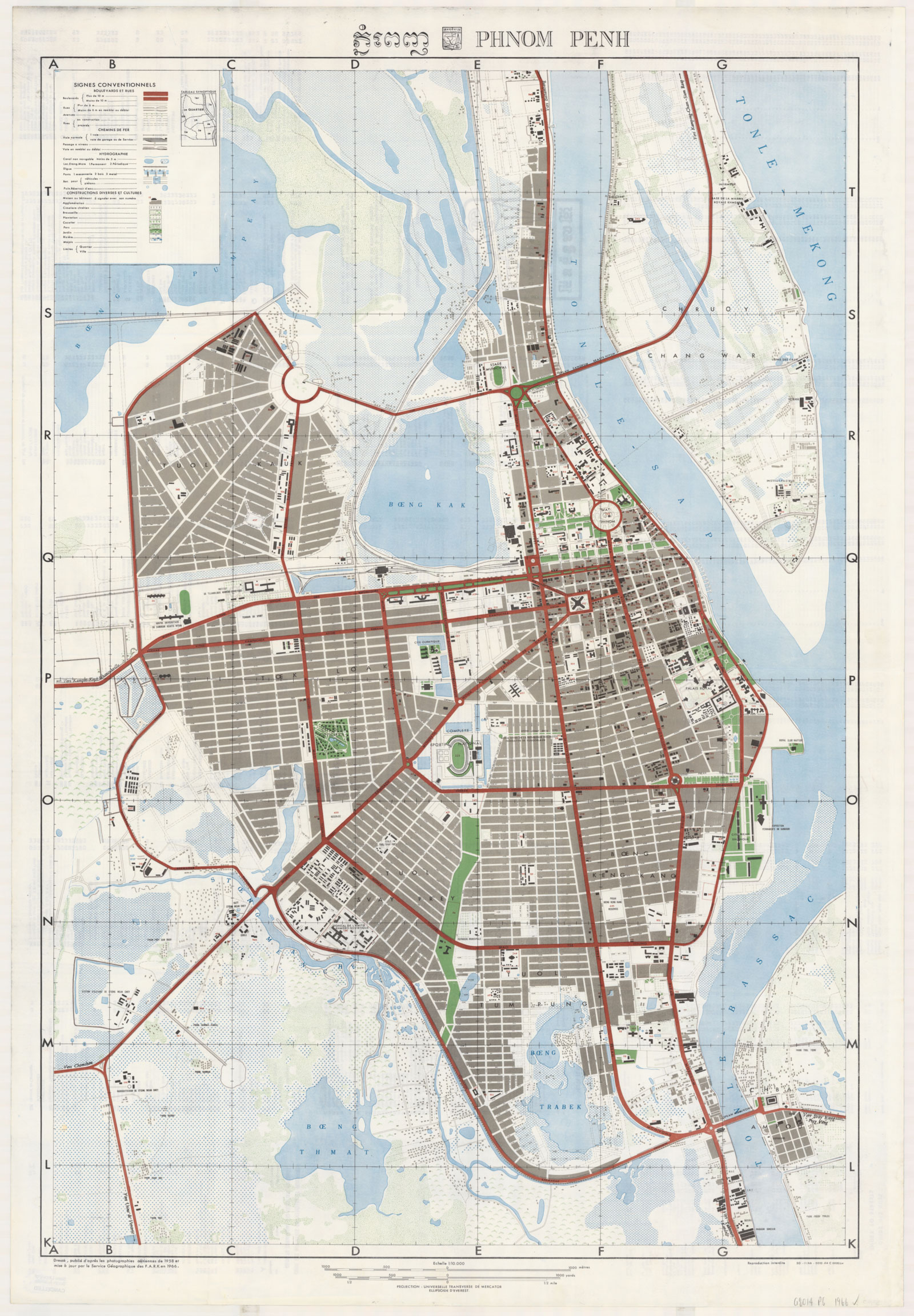
This series of historic maps starts in 1864 with one of the first produced by colonial cartographers, charting the territory after King Norodom granted French protectorate status over Cambodia a year earlier. The maps that follow depict what became Cambodia’s capital in 1865 at various points in its history, spanning from simple sketches drawn in spindly black ink on yellowed parchment, to modern colour-coded iterations from the mid-20th century.
Through the progression of maps, a reader can trace the gradual development of the capital and expansion away from a riverside settlement into a modern city. In 1864, the French cartographer barely depicted anything but a sparsely settled landform, tracing the banks of the Mekong, Tonle and Bassac rivers, as well as the peninsula of Chroy Changvar.
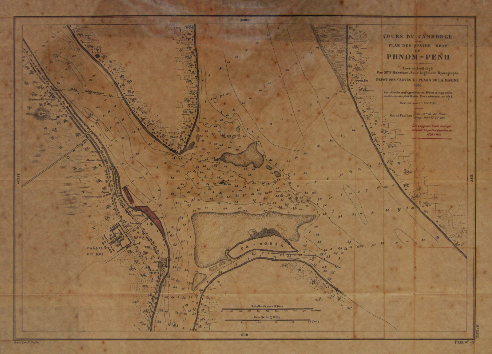
These forms would change considerably over the decades, moulded under the constant pressure of river tides.
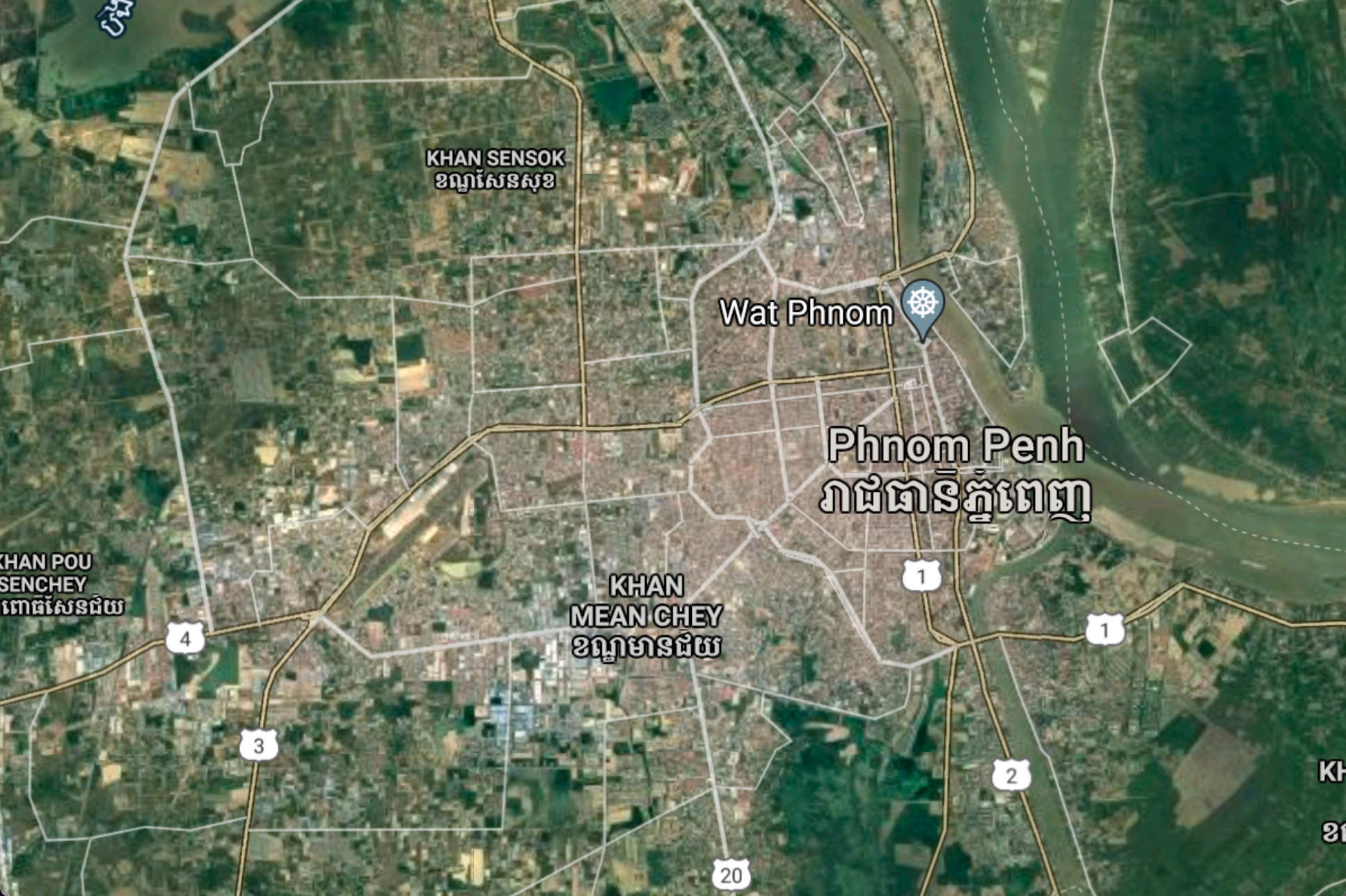
In early maps, the mouth of the Bassac was closer to the Cambodian Royal Palace than it is today. Interestingly enough, an island called Koh Norea (labelled Ca Norea) appears at the mouth even in the oldest map of the collection. At that time, it was a natural island being lost to erosion. Today, Koh Norea is a controversial land reclamation megaproject built downstream of its original location by Overseas Cambodia Investment Corporation (OCIC), Cambodia’s biggest development firm, using sand dredged from the surrounding rivers.
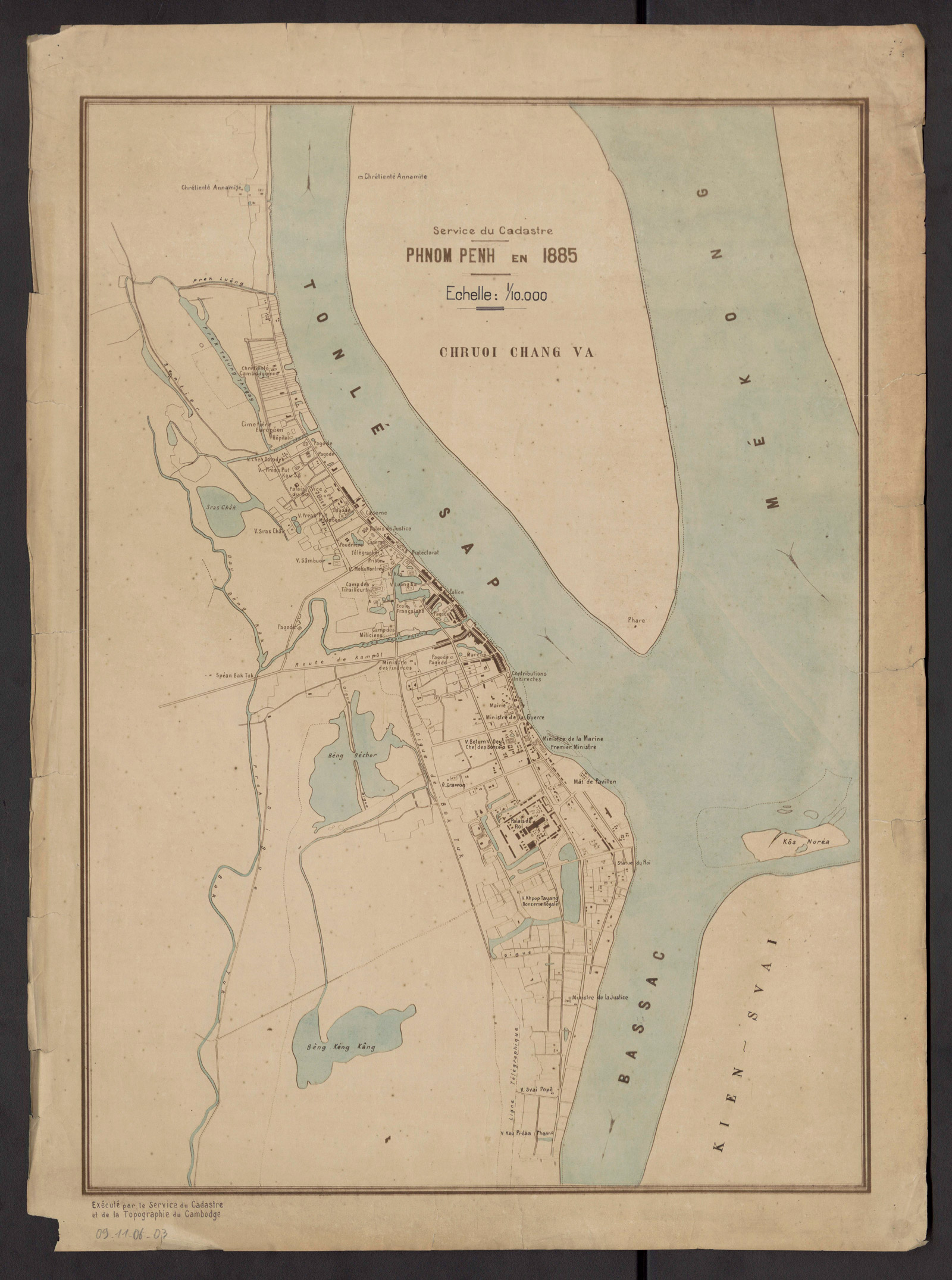
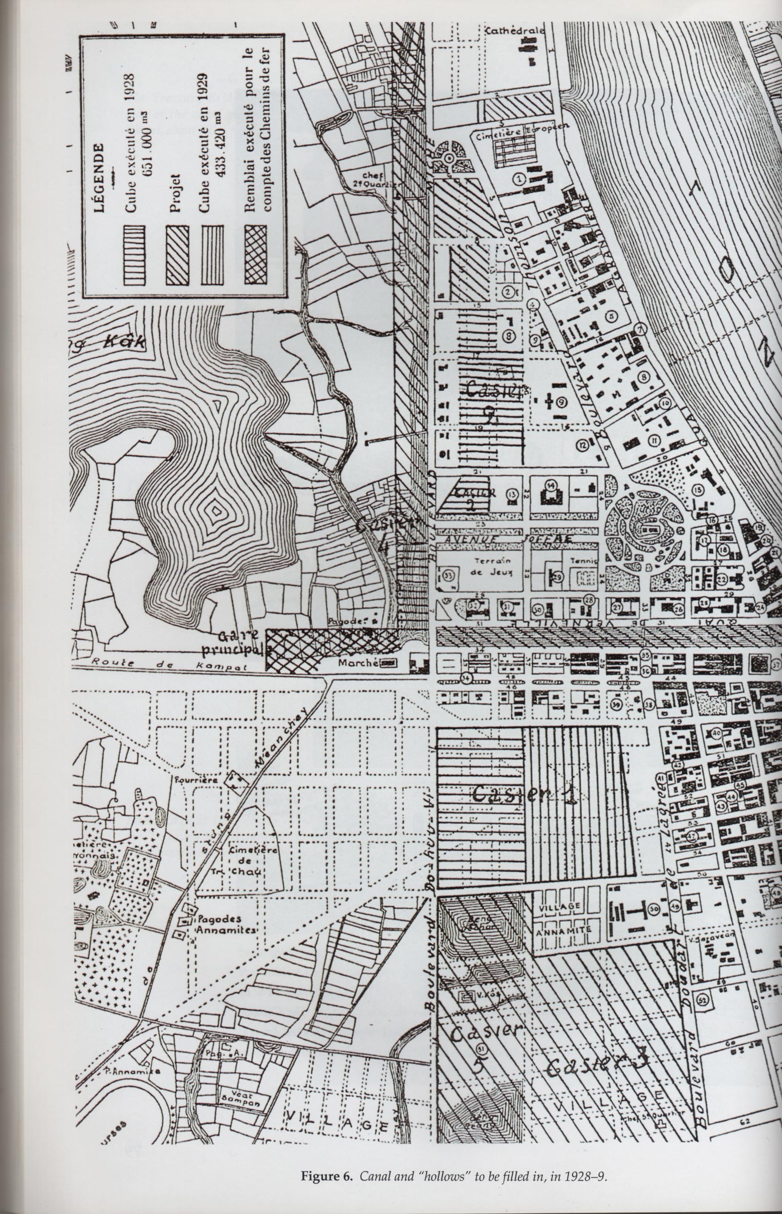
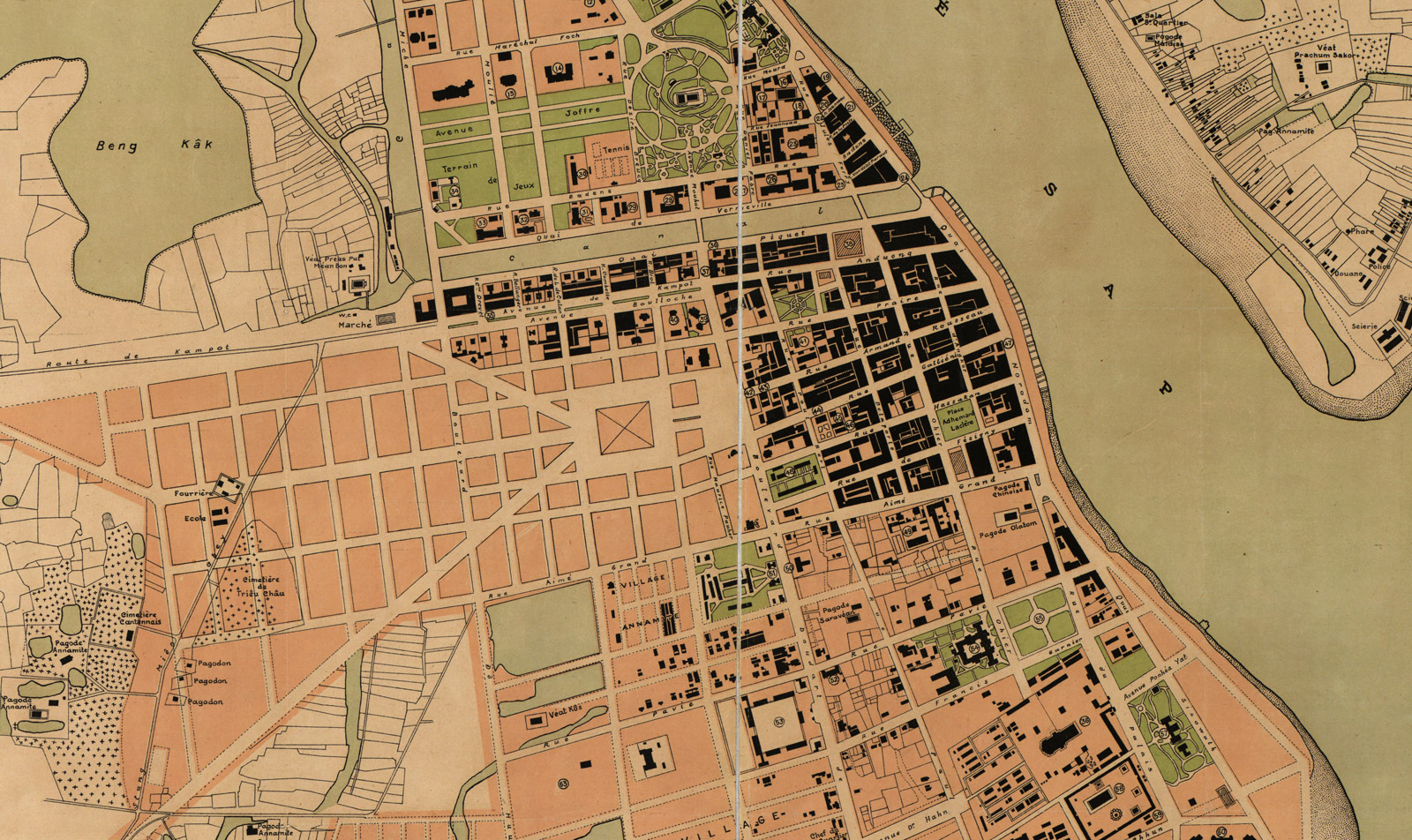
By 1885, cartographers began depicting the city as a growing urban centre, with a web of roads branching to the south to encompass the Royal Palace. The city hadn’t yet expanded westward to Boeng Kang Keng, then still a natural lake. It wasn’t until 1921 until the first map appearance of Boeng Kak, the city’s northern lake filled in for development around 2010. Though the infill displaced thousands of residents in a protracted and embattled process, the lake appeared in light blue ink for years as a major feature of each subsequent map.
Though filling bodies of water is a key feature in modern Phnom Penh, it was practiced extensively by French administrators who built up the city on such former lakes of Boeung Raing, Boeung Keng Kang and the human-made Boeung Decho.
That 1921 map was also distinct for depicting the urban settlements of Chroy Changvar, which before had been drawn as a featureless mass. Most of the maps were drawn by cartographers during the French protectorate period and many reflect colonial features, including quarters labelled as inhabited by residents of different ethnic or racial backgrounds, and a grid system for city streets.
Today, almost seven decades removed from French oversight of the capital, the development of Cambodia has taken its own style, guided by international investment and a booming construction sector.
The remaining lakes and wetlands have been filled at a voracious pace to make room for residential and commercial properties. Koh Pich, the original extension of the city into reclaimed land, sprouted from a marshy island of silt beginning in 2006 under development from OCIC.
Other reclamation projects are changing even further the natural landforms along the rivers – only this time, that transformation is being done by human hands.
Click maps to enlarge and zoom