At first Kiki Mariam wasn’t too concerned as the tail end of a cyclone sent cascades of roof-rattling rain onto the riverside home she shared with her husband Robitan in Bima, a city of around 170,000 people on the Indonesian island of Sumbawa.
“The water was low but then it got higher,” the 37-year-old recalled, one hand resting on a sawdust-speckled workman’s table, the other pointing to the riverbank a couple of yards away.
Now the river is flowing as normal, about ten feet below ground level down a 70 degree angle bank. But during that mid-December morning in 2016, as the rain beat down hour after hour, Mariam saw the river’s ineluctable swell and soon forgot her breakfast-time frustration about a leaking roof.
“I didn’t think it would get higher than that,” Mariam said, pointing at the riverbank. But as the rain hammered down relentlessly, the river rose and rose, until the water, ominously, was climbing close to ground level.
“We saw it wasn’t going to stop – it took quite a long time, but it came,” Mariam said. “I was really scared, we were asked to leave, so we grabbed what we could and moved away from the river,’ she said, as husband Robitan, 39, pointed to a head-high spot on a nearby wall, the faded difference in hue indicating the high water mark of the 2016 deluge that destroyed their house and left 100,000 people homeless in and around Bima.
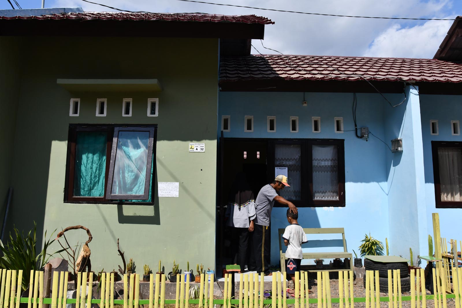
An area five meters either side of the river was declared off-limits, with around 1,200 of the riverside community relocated. The remnants of Mariam and Robitan’s inundated house now function as a carpentry workshop run by Robitan’s father, 58 year old Rum Diah, and the family has been rehoused about three miles away in a new government estate at Jatiwangi, where small single-storey pastel dwellings mirror the bright blue of the sky above.
As natural disasters go in Indonesia, a vast archipelago that spans a distance equivalent to that from Ireland to Iraq and sits on the so-called Ring of Fire, flash floods usually barely register – unless they hit the vast capital Jakarta, where years of subsidence have finally convinced the government to relocate the nation’s capital to Borneo.
Indonesia is in a part of the world that is more disaster-prone than elsewhere. A United Nations report published late last year showed that from 2014-17, the Asia-Pacific region was hit by 55 earthquakes, 217 storms and cyclones and 236 cases of severe flooding – disasters that affected 650 million people and killed 33,000.
“Some islands have different kinds of disasters, Java has floods, volcanoes, earthquakes, in Sumatra now we are dealing with forest fires, East Nusa Tenggara is drought-prone, Kalimantan now has forest fires. Everywhere can face earthquakes”
Arifin Hadi, Indonesian Red Cross
Seismically hyperactive Indonesia, however, is arguably even more vulnerable than most countries in that disaster-prone region, as anyone who has the app of the Indonesia’s Meteorology, Climatology and Geophysical Agency – or BMKG, to use the Indonesian acronym – on their phone knows. Earthquake notifications pop up a couple of times a day on average, with the week of 15-22 September seeing 16 earthquakes across Indonesia, going by the alerts, the biggest a magnitude 6.4.
The ubiquity of disaster in Indonesia is such that Sutopo Purwo Nugroho, the former spokesman for the National Disaster Management Agency, or BNPB, was a household name before his death in July from cancer. His passing was widely covered by international media, a sign of how often the affable “Pak Topo” had to tell the world about the latest disaster to befall his country.
Arifin Hadi of the Indonesian Red Cross, which is usually among the first responders when disaster strikes, said that his country is probably unique for the frequency, range and scale of disasters it faces, all compounded by geographic challenges that stymie mitigation and relief work.
“We have over eighty thousand kilometers of coastline and we are vulnerable in many parts of the coast to tsunami,” said Hadi, who works as the organisation’s disaster management head.
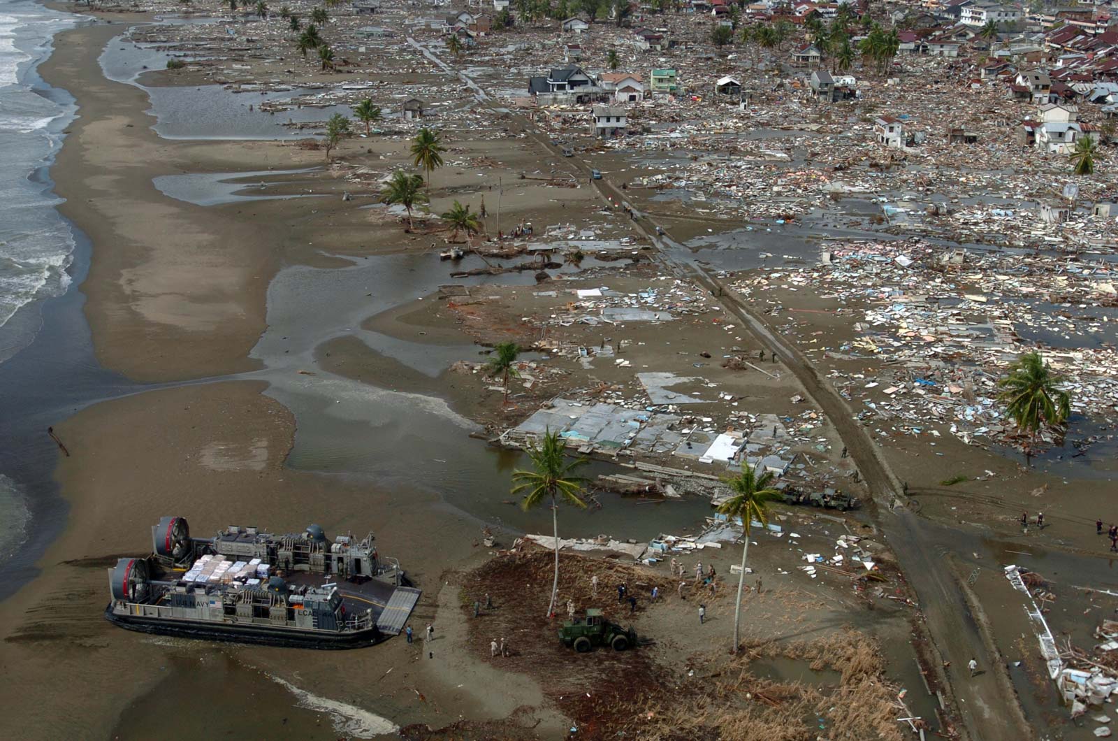
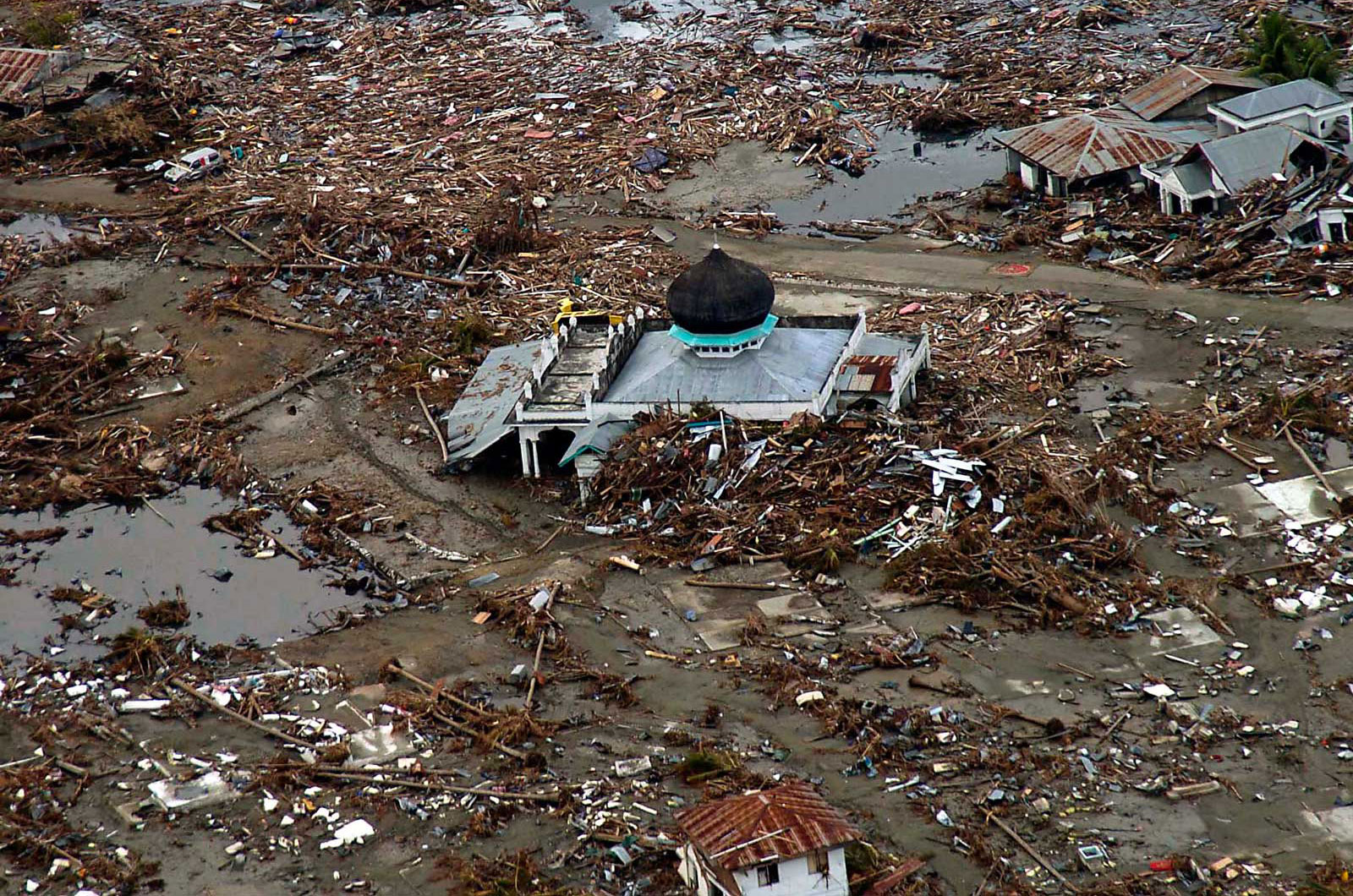
The world’s most destructive natural disaster of recent times was a tsunami – and a largely Indonesian tragedy. In 2004, a magnitude 9.1 earthquake – the third biggest on record – thundered for around eight minutes off the coast of northern Sumatra and sent what became a colossal wave billowing across the Indian Ocean.
The tsunami measured a hundred feet high in places, flattening coastal towns and killing an estimated 230,000 people in at least a dozen countries. Indonesian deaths numbered around 170,000, most of them in the westernmost province of Aceh.
Made up of over 13,000 islands – or 17,000-plus, going by some estimates – Indonesia’s scattered and watery vastness contributes to its catalogue of catastrophe, Hadi explained, drawing breath as he launched into what could easily have been a much longer list.
“Some islands have different kinds of disasters, Java has floods, volcanoes, earthquakes, in Sumatra now we are dealing with forest fires, East Nusa Tenggara is drought-prone, Kalimantan now has forest fires,” Hadi added, tailing off with an ominous “everywhere can face earthquakes.”
As if on cue, a magnitude 6.8 earthquake struck near Ambon, the main town in Maluku in Indonesia’s east, on September 26, with at least 20 people killed at time of writing.
Rahmawati Husein, vice chair of the Muhammadiyah Disaster Response Centre, said her group responds to between 40 and 70 “small to mid-scale events” a year, on top of whatever major disasters hit the archipelago. “It is one of the big challenges we face in Indonesia, that we are an archipelagic country,” she said.
Last year Indonesia was hit by three major natural disasters. In July and August a series of earthquakes around the magnitude 7 mark rattled Lombok, an island sitting a short ferry trip across the Alas Strait from Sumbawa, killing nearly 600 people.
On the night of December 22, part of the rumbling Anak Krakatau volcano collapsed into the Sunda Strait between Java and Sumatra, the two most populous Indonesian islands, sending a wall of water crashing into the adjacent coastlines and leaving more than 400 people dead.
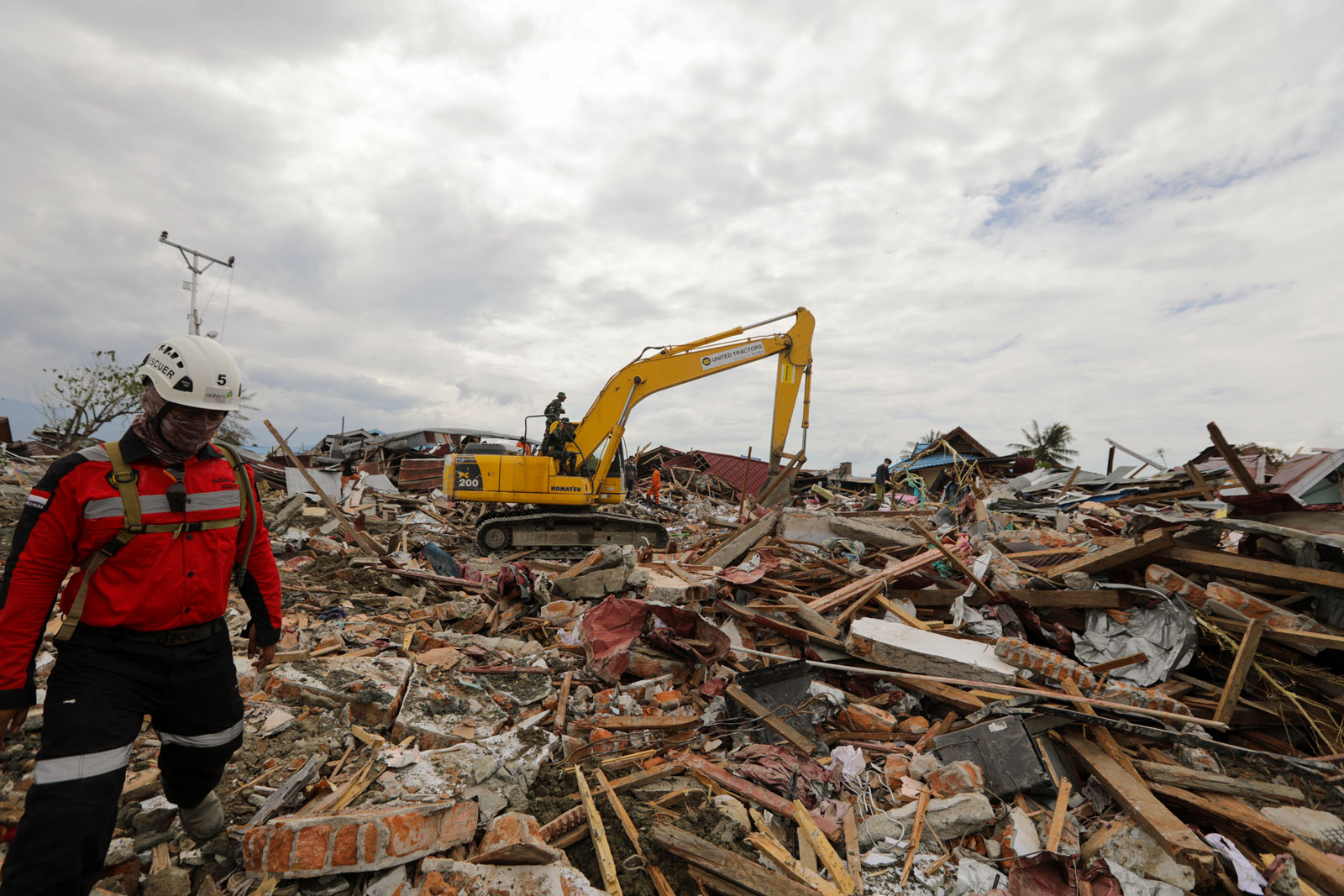
The most destructive tectonic tragedy to hit Indonesia in 2018 was the magnitude 7.4 earthquake and tsunami that hit the Central Sulawesi town of Palu and surrounding villages on September 28, killing over 3,500 people and leaving nearly a thousand others missing.
Not only did the temblor send a wave up to 20 feet high crashing over the city of Palu and surrounding villages, it churned up patches of land into a deadly churning vortex. This process, known as liquefaction, dragged buildings, cars and people down into the earth, even burying dozens who were attending a funeral as the earthquake struck around sunset.
“The people who originally came from there, fishermen still live and build on the beach because they have become part of the customs of their ancestors as fishermen. Tsunami are nature so they not worry ’cause life and future come from God”
Imade Boby, originally from Palu
Hadi said the Sulawesi double-disaster was more challenging to deal with than Lombok or the Sunda Strait. “The most complicated was handling the earthquake in Palu because you have tsunami and liquefaction at the same time,” he said, before reminding of the various logistical hurdles faced by relief workers in getting heavy-lift machinery – needed to remove huge chunks of rubble – to an island a three-hour flight north and east of Jakarta.
Palu’s airport had been damaged and roads into the stricken town were at first partly cut off, delaying aid supplied from Makassar, the biggest city on Sulawesi, a 12-hour drive away at the best of times. Those were just the main hurdles around Palu, and did not even begin to capture the difficulties faced by people in small villages cut off from outside help for days.
A year on, Palu is recovering, albeit slowly, said Imade Boby, who is from the town and who spent several days searching for family members after last year’s disaster. All had survived the impact of the wave but amid the wrenching chaos in the town, tracking people down was not easy during those first days.
The International Federation of Red Cross and Red Crescent Societies said on September 23 that out of 103,000 houses destroyed or damaged in the disaster, 14,300 households are still in shelters or temporary accommodation.
Some people, such as those who previously lived on land ground up by the liquefaction process, have been relocated, with the areas declared off-limits for human habitation.
Not everybody wants to move, however. “For now there are some people who are still building houses on the beach – and some are choosing not to build on the beach because most of the tsunami victims are still traumatised,” said Boby.
“The people who originally came from there, fishermen, still live and build on the beach because they have become part of the customs of their ancestors as fishermen,” he explained. “Tsunami are nature so they not worry ’cause [they believe that] life and future come from God.”
Rahmawati Husein’s MDMC, which was set up after the 2004 tsunami by Muhammidiyah, one of two Islamic mass organisations in Indonesia, has fixed farm irrigation systems and donated boats and engines to fishermen whose livelihoods were ruined. “Groups such as MDMC can help fill the gaps by providing necessities to the community,” said Husein, who has worked in Palu since the disaster.
In a vast country of 270 million people, some of it densely populated and with habitats that vary from dense jungle to parched badlands, relocation is not always an option – especially for coastal communities that fish for a living.
With the right training and information-sharing, lives need not be lost when the inevitable happens, as the ubiquity of instant messaging, social media and apps such as the BKMG’s allow information to be quickly relayed, officials believe.
“There is jargon 20-20-20. This means that if there is an earthquake that occurs for 20 seconds, residents have 20 minutes to go to a height of 20 meters,” said Agus Wibowo, spokesman for the government’s disaster management agency.
Nowadays along the coast of Banda Aceh, among the worst-hit towns in the 2004 Indian Ocean tsunami, fishermen stand on shore, the very spot where a decade and a half ago a wall of water ten meters high welled up and raced miles inland, swallowing all before it.
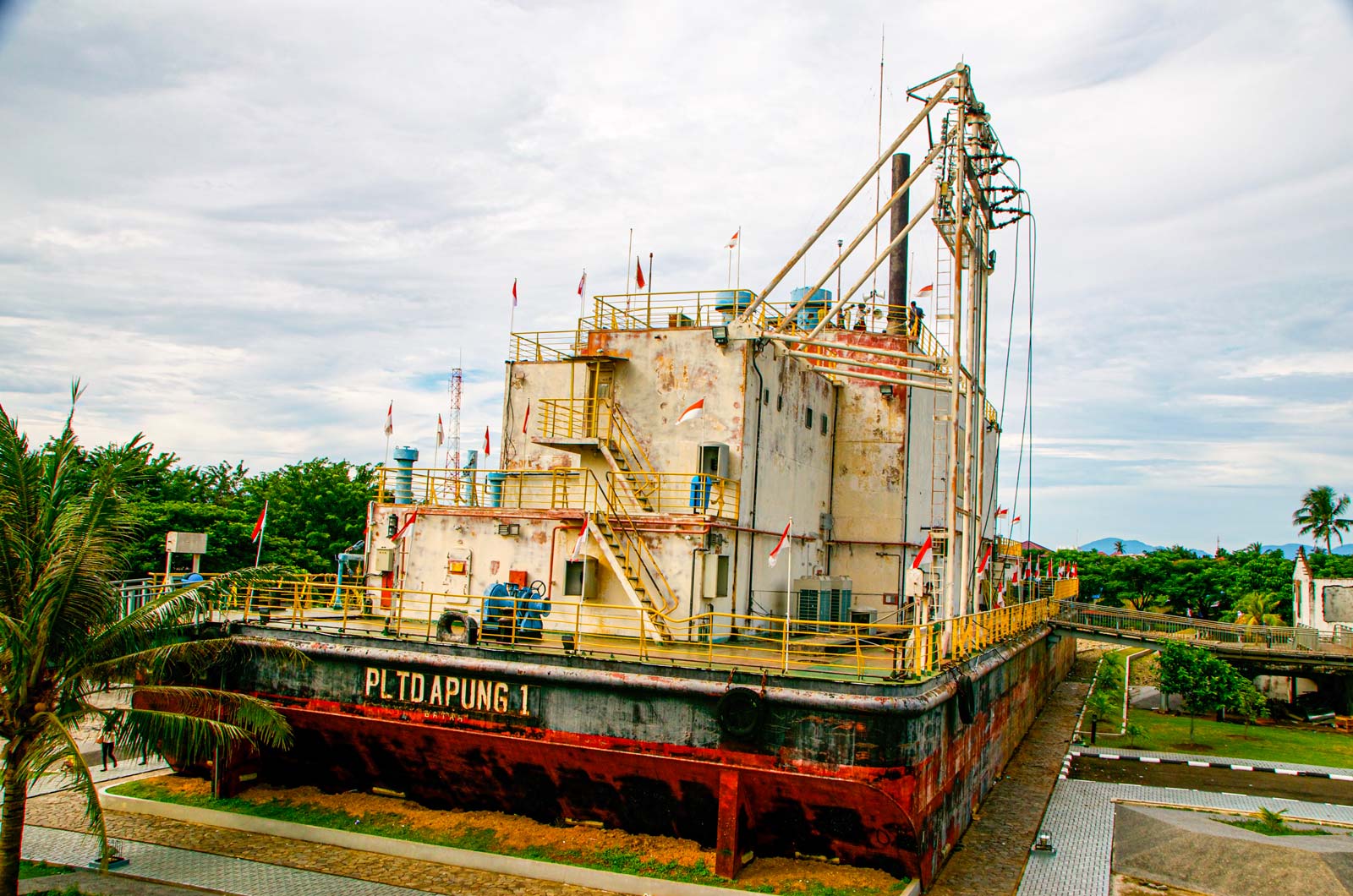
A 2,500 tonne power generation ship that was carried inland by the 2004 tsunami now sits in downtown Banda Aceh as the centerpiece of a tsunami memorial. Photo: Simon Roughneen
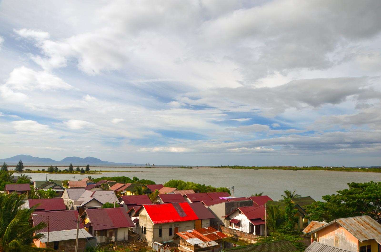
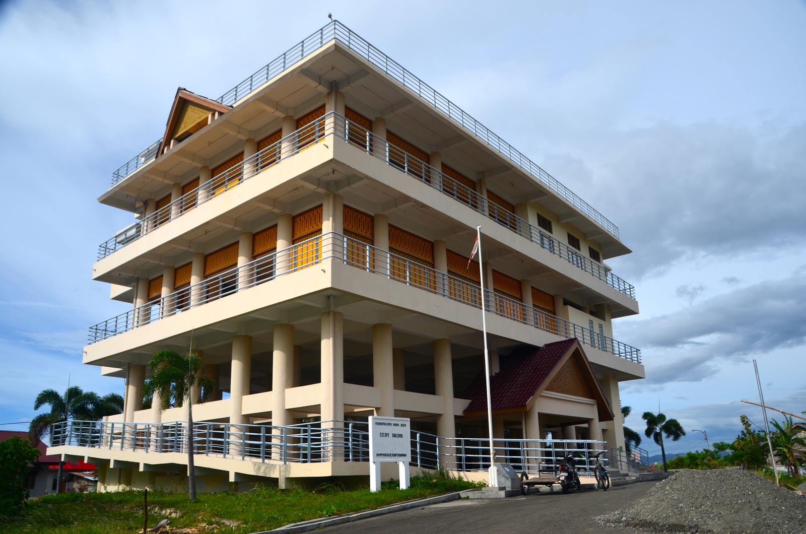
Nearby, multi-storey evacuation towers built after the 2004 mega-disaster dot the coastline, meaning that Acehnese will continue to live by the sea, as their forebears have done for millennia.
But both the expensive national offshore tsunami warning system as well as the nature and timing of official tsunami alerts on the day of the Sulawesi disaster have been heavily criticised, with warning buoys found to be in disrepair – some even looking as if they had vandalised.
“It is important to strengthen early warning equipment,” said the Red Cross’s Hadi, who added that local and international aid agencies and Indonesia’s national government need to work more closely with the heavily decentralised archipelago’s local or regional authorities.
Such coordination is not guaranteed, however, in a bureaucracy where national and local laws are often contradictory and where responsibilities are sometimes vaguely allocated.
“We have to be able to train local actor[s] to be local responder, first responder,” Hadi added, explaining that with so many scattered and remote islands, all at risk of disaster, it can take time for aid and relief to arrive.
“In the end it is the community that has to react first,” agreed Rahmawati Husein.
As with the fishing families from coast al Sulawesi, not everyone who lives in the line of nature’s fire wants or arguably needs to move, meaning that relocation is likely to be but one solution to Indonesia’s multiple disaster mitigation conundrums.
“Take the example of the people on the slopes of Merapi. There were villagers who did not want to evacuate. Local governments cannot force them to move. This is indeed difficult because it is related to social and cultural attachment,” said Wibowo, referring to Mount Merapi, a volcano which has erupted frequently for hundreds of years and sits near the royal city of Jogjakarta in Central Java.
“One of the efforts is to improve evacuation routes for them and early warning that can be accessed quickly. The Merapi slope community is very close to a transistor radio. They will quickly analyse or get information if Merapi will experience an eruption,” he said.
“I couldn’t save one building but thank God I could save my family and life”
Robitan, Bima flood evacuee
Back in Bima, the feeling is that if there is no need or compelling reason to live near a flood-prone river, then why not move if the government provides housing.
“We were worried if people would want to be relocated here, but we have a waiting list,” said the city’s mayor, Muhammad Lufti, discussing the Jatiwangi project.
Lukki Dwi Chanani, a 29-year-old divorcee with a young daughter, had already arrayed about a dozen potted plants along the front gable of her new house in Jatiwangi, which she had moved into just a couple of weeks before.
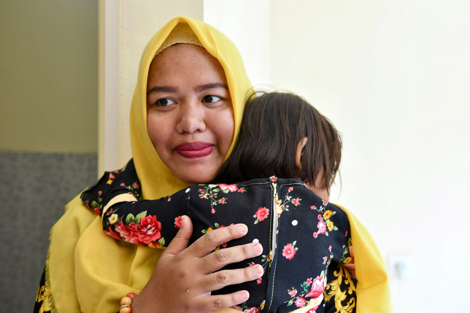
Chanani, who works part-time as a teacher, said that her main concern is her toddler daughter. “The nearest community health centre to here is only a kilometer away,” she said. It’s close, but yet so far compared to her previous abode, where a doctor practiced just 50 yards up the same street she lived on.
All the same, she thinks that the community is better-off away from the river. “I’m a bit sad but have no choice because that place is not good to live [in],” she said.
Down the street in the new Jatiwangi estate, Robitan said that moving was the best option, all things considered, though the transition was tinged with sadness.
“My family had lived there for generations,” he said of the house lost to the 2016 storm. “But every time it was raining we were hit by a flood.”
High-fiving his four-year-old son Amin, as he turned from the scorching midday sun to head indoors, Robitan recalled with a mix of relief and regret that morning three years ago when the river rose to swallow his old house
“I couldn’t save one building, but thank God I could save my family and life.”